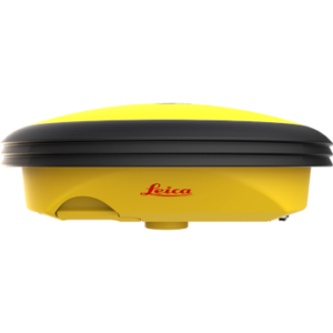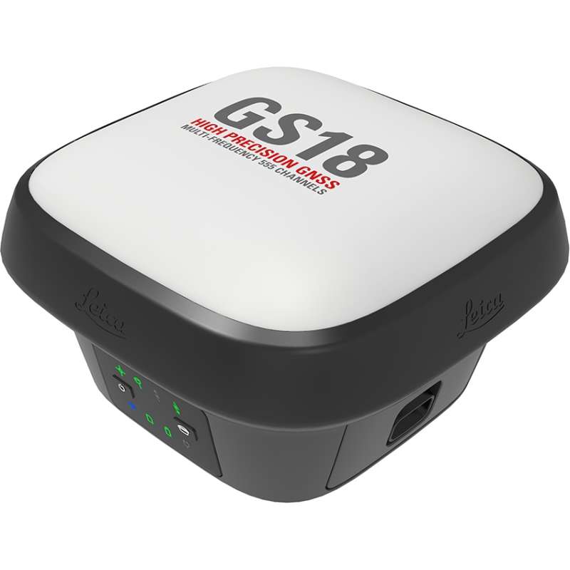


Leica GS18 T GNSS Smart Antenna
Price on Application
Description
Redefining Precision With the Leica GS18 T GNSS Smart Antenna
The Leica GS18 T GNSS Smart Antenna embodies a revolutionary advancement in Global Navigation Satellite System (GNSS) technology.
Created for modern construction and surveying professionals, this smart antenna blends advanced features with user-friendly functionality, setting a new standard in accurate positioning and efficiency.
Unmatched Performance with True Tilt Compensation
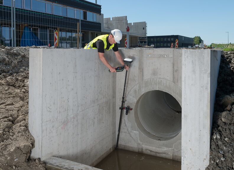
Experience the world’s fastest and easiest-to-use GNSS RTK rover with the Leica GS18 T. This device offers accurate tilt compensation, is immune to magnetic disturbances, and requires no calibration.
You can measure any point with speed and ease without holding the pole vertically. This innovation combines GNSS and inertial measurement unit (IMU) technology, allowing for accurate tilt-compensated surveying.
Whether working near metallic objects or in areas with magnetic disturbances, the GS18 T ensures reliable and quality measurements.
Advanced GNSS Signal Tracking
The Leica GS18 T GNSS enhances GNSS signal tracking quality, ensuring precise and dependable data capture. This smart antenna offers smooth data transfer and internal storage, eliminating the need for costly site revisits.
Superior Integration with Leica Software
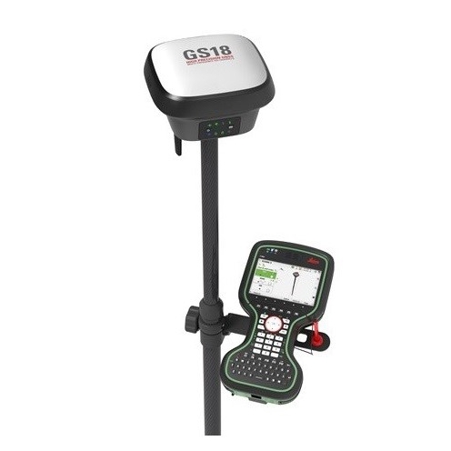
Seamlessly integrate the Leica GS18 T with Leica Captivate and Leica Infinity software for comprehensive data capture, processing, and analysis.
Leica Captivate’s engaging interface spans industries and applications, while Leica Infinity allows you to join previous survey data and edit projects. This integration keeps your project on track from field to office, boosting productivity and precision.
A Wide Choice of Versatile Applications
The Leica GS18 T GNSS Smart Antenna excels in various applications:
-
- Construction – Ideal for stakeout tasks, site layout, and monitoring.
- Mapping – Create workable 3D models and detailed maps.
- Surveying – Enhance conventional surveying practices with advanced digital methods.
- Monitoring – Track infrastructure changes with high positioning accuracy.
- Utility Identification – Precisely locate and document underground utilities.
- Accessory Compatibility – Compliment your Leica GS18 T GNSS smart antenna with a wide range of survey equipment accessories.
Enhanced User Experience
Designed for challenging environments, the Leica GS18 T GNSS features a user-friendly interface and robust construction. Its multi-frequency capabilities and integrated quality assurance ensure consistent performance.
The inertial micro units and proper tilt compensation solution provide accurate positioning even near metallic objects and other interferences.
Efficiency and Productivity
Maximise job site efficiency with the Leica GS18 T. This GNSS smart antenna is ready to use directly out of the box without extensive calibration, allowing you to focus on your task and save time.
As the fastest GNSS RTK rover, it supports smooth data transfer, ensuring that measured and designed data can be viewed and processed seamlessly.
Why Choose the Leica GS18 T?
The Leica GS18 T GNSS is more than a smart antenna—it’s a comprehensive solution that integrates smoothly with any workflow.
With Leica Geosystems’ renowned reliability and the latest in GNSS and inertial measurement units, the GS18 T offers a competitive edge for professionals who demand excellence in surveying equipment.
Featured Highlights:
- Accurate Tilt Compensation – Immune to magnetic disturbances and calibration-free.
- Advanced GNSS Signal Tracking – Ensures dependable measurement quality.
- Integration with Leica Software – Compatible with Leica Captivate and Leica Infinity.
- Versatile Applications – Ideal for construction, surveying, mapping, and more.
- User-Friendly Design – Ready to use out of the box without calibration.
Explore our range of advanced surveying solutions
Explore our range of advanced surveying solutions with Leica Captivate and discover how Leica’s cutting-edge technology can enhance your construction and surveying projects.
Features
- The Lecia CS35 tablet and CS20 Controller provide the essential control, convenience, and absolute mobility
- Share Data Among Instruments
- Increased measurement productivity and traceability
- Calibration-Free
- Immune to magnetic disturbances
- Integrated quality assurance of pole tilt
- Reduction of human error
- 555 channels for more signals, faster acquisition and improved sensitivity
- Intelligent management of multi-frequency, multiconstellation signals
- Intelligent selection to automatically reject reflected or noisy signals
- Achive centimetre accurate positioning worldwide – perfect when working in remote areas around the globe
- No RTK base station or RTK network required, correction data is continuously transmitted by satellite delivering global coverage
- Bridging RTK outages for uninterrupted centimetre positioning
- Unique RTK technology provides continuous checks to guarantee correct results
- Initialisation within seconds
- Complete reliability
- IP66 / IP68 protection
- Built for extreme temperatures of 40°C to +65°C
- Fulfils toughest standards throughout the complete product lifetime
- Rugged aluminium housing
Downloads
Have a question?
Speak to our specialist today.
Contact Us
Speak to our specialist today.
Related products
-
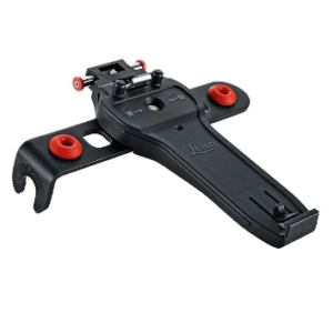
Leica GHT66 Holder for Field Controller Leica CS20
€115.00 excl VAT (€141.45 incl VAT) -
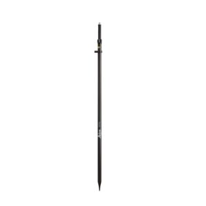
Leica GLS30 Telescopic Carbon Pole
€380.00 excl VAT (€467.40 incl VAT) -
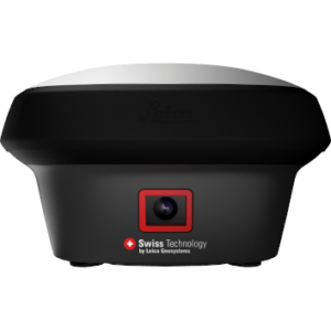
Leica GS18 I GNSS RTK Rover with Visual Positioning
Price on Application -
Leica iCON iCG30
Price on Application