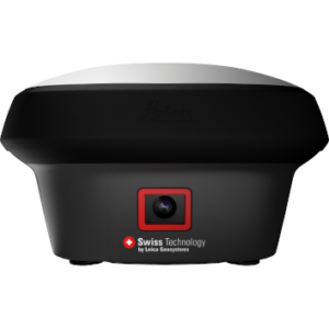
Leica iCON iCG30
Price on Application
Description
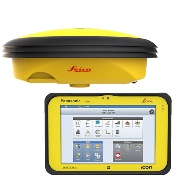
The Leica iCON iCG30 is an advanced GNSS RTK rover tailored for construction professionals seeking efficiency and precision in their projects.
With its integration of modern digital methods and advanced RTK technologies, the iCG30 leverages capable design features to streamline typical construction workflows and enhance productivity on-site.
Versatile Applications of the Leica iCON GPS 30
The Leica iCON GPS 30, powered by Leica iCON field software, is designed to enhance construction project efficiency across various sectors significantly. Here are some examples:
- Boosting Construction Productivity: The Leica iCON GPS 30 uses digital measurement techniques to increase the productivity of any construction project, ensuring tasks are completed faster and more accurately.
- Utility Construction Documentation: Precisely defines and documents the positioning of infrastructure such as water and sewer lines, oil and gas pipes, or power and communication lines, streamlining the utility construction process.
- Building Construction and Real Estate: Effectively stakes out rough outlines for subsequent building construction tasks or subdividing real property, translating design plans into precise physical markers on the ground.
- Landscape and Road Construction: Transfers design outlines directly to the field in landscape gardening projects or road construction, enabling accurate real-world rendering of plans.
- Surveying for UAV Workflows: Conducts simple surveys of ground control points, essential for UAV (Unmanned Aerial Vehicle) workflow integrations, enhancing the accuracy of aerial surveys and mappings.
- Machine Control Integration: Seamlessly integrates with machine control systems to guide heavy machinery in real-time during earthmoving and grading operations, increasing precision and reducing manual adjustments.
- Infrastructure Monitoring: Employs advanced GNSS tracking to monitor existing infrastructure’s structural integrity and displacement, which is crucial for maintenance and safety assessments.
Are you looking for a different GNSS solution? Explore our range of Leica GPS systems designed to meet diverse construction and surveying needs.
Advanced GNSS Performance for Construction Sites
The Leica iCON GPS 30 combines innovative technology and user-centric design to support a wide range of construction and surveying applications. Below are some of the standout features of this robust GNSS system.
Precision Stakeout Capabilities
The iCON GPS 30 features a balanced, lightweight, and compact design, making it exceptionally comfortable to use and carry throughout the workday. It offers unparalleled position reliability in its class, making it an ideal choice for precision stakeout tasks.
Advanced Connectivity Options
Equipped with integrated mobile data, long-range Bluetooth, and WLAN, the iCON GPS 30 ensures seamless communication on the job site. These features allow for efficient data transfer and real-time collaboration, boosting productivity across project teams.
Streamlined Operation with User-Friendly Interface
The iCON GPS 30 has an intuitive user interface that simplifies complex tasks and enhances usability. The interface is tailored to the needs of modern construction workflows, enabling operators to achieve more with less.
Clear Visualization with a High-Definition Display
The device boasts a high-definition display that provides clear and crisp visuals even under bright sunlight. This feature ensures surveyors can easily read data and navigate menus, enhancing productivity and reducing eye strain.
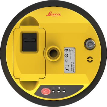
Durable Construction for Harsh Environments
With an IP68 rating for dust and water resistance, the iCON GPS 30 is built to withstand the rigours of harsh environments. Its durability ensures it can operate in various conditions without compromising functionality or accuracy.
Explore our selection of survey equipment accessories for a broader range of products and to enhance your survey kit.
Need a Flexible Surveying Solution?
At SISIRL, we provide flexible and budget-friendly solutions tailored to your project needs. If you’re looking for the perfect rental option, contact us to discuss how we can support your requirements.
Additional Information
Compatible with:
- Leica iCON CC70 and CC80 field controller
- Leica iCON field software
Features
- Entry-point into Leica iCON GNSS performance: Easy to use and equipped with the construction tailored Leica iCON site field software, the iCON GPS 30 facilitates your entry into the Leica iCON GNSS portfolio
- Lightest pole weight: The light, compact and balanced design makes it comfortable to use and carry in the field
- Reliable and accurate measurement results: With the highest level of position reliability in its class, the iCON GPS 30 delivers accurate results and increases productivity
Downloads
Have a question?
Speak to our specialist today.
Contact Us
Speak to our specialist today.
Related products
-
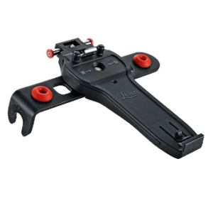
Leica GHT66 Holder for Field Controller Leica CS20
€115.00 excl VAT (€141.45 incl VAT) -
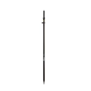
Leica GLS30 Telescopic Carbon Pole
€380.00 excl VAT (€467.40 incl VAT) -
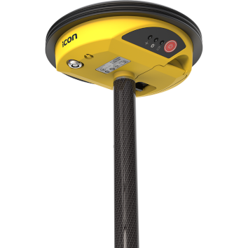
Leica GS18 I GNSS RTK Rover with Visual Positioning
Price on Application