Do you need further help?
Contact Us

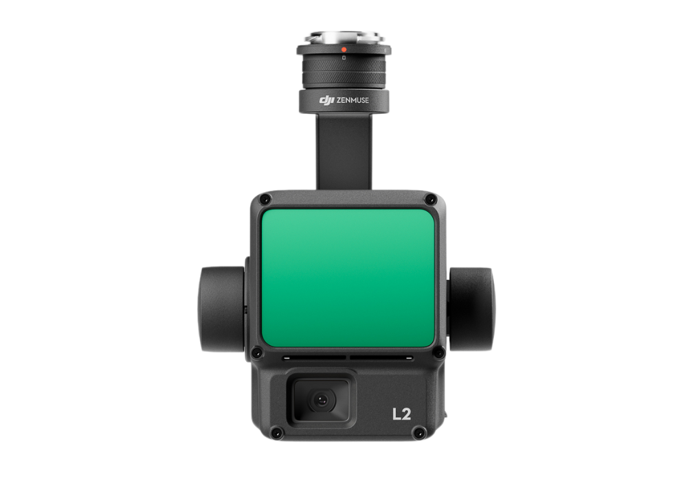
Zenmuse L2

€521/Day , €1250/Week

Categories: , ,

Description

Zenmuse L2 integrates frame LiDAR, a self-developed high-accuracy IMU system, and a 4/3 CMOS RGB mapping camera, providing DJI flight platforms with more precise, efficient, and reliable geospatial data acquisition. When used with DJI Terra, it delivers a turnkey solution for 3D data collection and high-accuracy post-processing.

Integrated LiDAR Solution

Supported by its powerful hardware, L2 can allow for a precise scan of complex subjects within an extended range and faster point cloud acquisition. During operations, users can preview, playback, and process point cloud models on-site, with Task Quality Reports generated by DJI Terra, offering a simple, one-stop solution to improve overall efficiency. This enables users to achieve high-precision point cloud results with one-stop post-processing.

High-Level Precision

By combining GNSS and a high-accuracy self-developed IMU, this solution achieves 4cm vertical accuracy and 5cm horizontal accuracy. 

Exceptional Efficiency

It’s ready for work as soon as it’s powered on and can collect both geospatial and RGB data from a 2.5km2 area in a single flight.

Tech Spec

Product Name – Zenmuse L2

Dimensions – 155×128×176 mm (L×W×H)

Weight – 905±5 g

Power – 28 W (typical) / 58 W (max.)

IP Rating – IP54

Supported Aircraft – Matrice 300 RTK (requires DJI RC Plus) / Matrice 350 RTK

Storage Temperature – -20° to 60° C (-4° to 140° F)

General Operating Temperature – -20° to 50° C (-4° to 122° F)

System Performance

Detection Range – 450m @50% reflectivity, 0 klx / 250m @10% reflectivity, 100 klx

Point Cloud Rate – Single return: max. 240,000 pts/s / Multiple returns: max. 1,200,000 pts/s

System Accuracy – Horizontal: 5 cm @ 150 m / Vertical: 4 cm @ 150 m

Real-Time Point Cloud Coloring Coding – Reflectivity, Height, Distance, RGB

LiDAR

Ranging Accuracy (RMS 1σ) – 2 cm @ 150 m

Maximum Returns Supported – 5

Scanning Modes – Non-repetitive scanning pattern, Repetitive scanning pattern

FOV – Repetitive scanning pattern: Horizontal 70°, Vertical 3°
Non-repetitive scanning pattern: Horizontal 70°, Vertical 75°

Minimum Detection Range – 3 m

Laser Beam Divergence – Horizontal 0.2 mrad, Vertical 0.6 mrad

Laser Wavelength – 905 nm

Laser Spot Size – Horizontal 4 cm, vertical 12 cm @ 100 m (FWHM)

Laser Pulse Emission Frequency – 240 kHz

Laser Safety – Class 1 (IEC 60825-1:2014)

Accessible Emission Limit (AEL) – 233.59 nJ

Reference Aperture – Effective Aperture: 23.85 mm (equivalent to circular)

Max Laser Pulse Emission Power Within 5 Nanoseconds – 46.718 W


Do you need further help?
Contact Us