What is Mobile Mapping and Where Can It Be Used?
Imagine being able to capture an entire cityscape, motorway network, or construction site in stunning detail while simply driving around. That’s the power of mobile mapping – a game-changing approach to collecting geospatial data that’s revolutionising how we document and understand our surroundings.
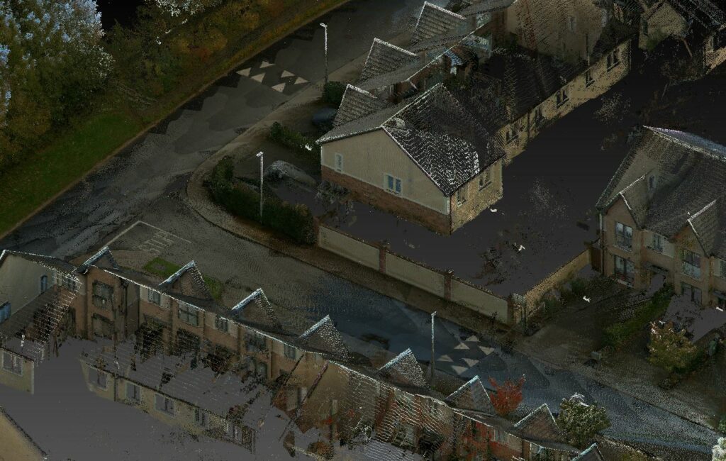
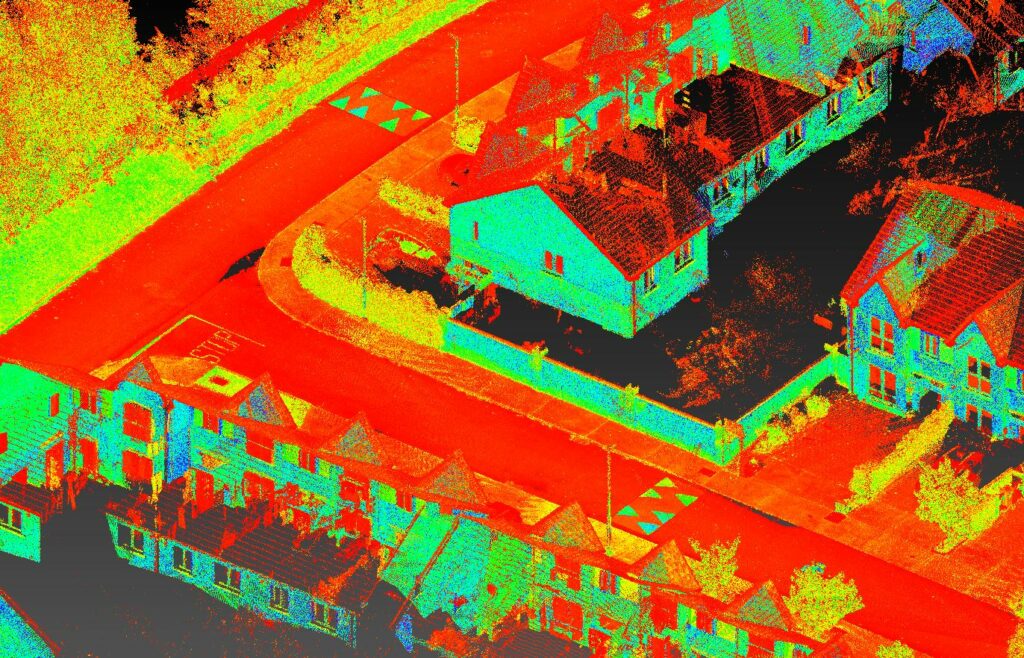
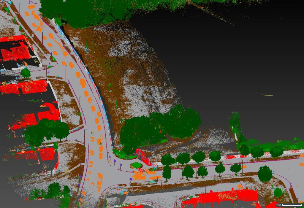
So, what exactly is mobile mapping? Mobile mapping involves the use of vehicles equipped with advanced sensing technology—including lasers, GNSS, LiDAR systems, radar, and high-resolution cameras—to capture comprehensive environmental data while on the move.
The beauty of this approach? What once took weeks of survey work can now be completed in hours. A single drive can collect terabytes of precise data that capture every kerb, signpost, building façade, and tree branch in remarkable detail.
Key Applications Include:
- Infrastructure Management: Quickly document roads, bridges, railways, and utilities for maintenance planning and asset management.
- Urban Planning: Create detailed digital twins of city environments for better planning and development decisions.
- Transportation: Map road networks, signage, and surface conditions for autonomous vehicle navigation and traffic management.
- Utilities and Services: Document the precise location of power lines, water pipes, and other critical infrastructure.
- Construction Projects: Monitor progress, verify as-built conditions, and create accurate documentation of completed work.
- Emergency Response: Generate up-to-date maps of disaster areas to aid in relief and recovery efforts.
The versatility of mobile mapping makes it an invaluable tool across numerous industries where precise spatial data is essential for informed decision-making.
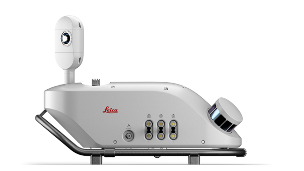
The Leica Pegasus TRK100
The Leica Pegasus TRK100 represents the cutting edge of mobile mapping technology. This intelligent, autonomous, and simplified system allows GIS professionals to map, know, and see environmental data with remarkable ease and precision.

Key Features:
Powerful Lightweight Design
Weighing just 14kg, the Pegasus TRK100 can be installed and operated by a single person, dramatically reducing personnel costs and making projects more efficient. Its ergonomic carrier platform features a rotational-tilt mount that facilitates installation by reducing the system lifting height by 36cm, eliminating risky lifting operations.
Advanced Scanning Capabilities
- Dual scanners capturing 600,000 measurements per second
- 32 beams with crossed line point cloud pattern
- Shadow-free point clouds thanks to multibeam scanning
- Unique MatchPoint technology that enhances point clarity for improved asset mapping accuracy
Comprehensive Imaging System
The modular camera system can integrate up to four additional 24MP camera pairs to capture front, side, and pavement angles. The system includes:
- 360° panoramic camera for complete environmental capture
- Butterfly side cameras with dual positioning options (vertical and horizontal) to capture architectural details and street-level features
- AI-enhanced imaging with automatic camera calibration
Built for Challenging Environments
The Pegasus TRK100 is designed to perform in the most demanding conditions:
- IP67 certified: Fully dust-tight and can withstand temporary water immersion
- Shock resistance: Withstands 4G shocks (ISO9022, MIL-STD-810H standards)
- Anti-fog camera lenses: Enables capture in rapidly changing weather conditions
All-Day Operation
- Battery unit that lasts up to 8 hours of continuous operation
- Hot-swap batteries eliminate complex vehicle modifications
- IATA-compliant transportation mode for easy storage and shipping of Li-Ion batteries
Privacy-Focused Design
The system features real-time AI algorithms that automatically identify and blur people and vehicles to ensure GDPR compliance from the moment data is captured.
Powerful Software Suite for Complete Workflow Management
The Leica Pegasus TRK100 is complemented by two powerful software solutions that streamline every aspect of the mobile mapping workflow:
Leica Pegasus FIELD
This innovative field software transforms the data collection process with features designed to maximise efficiency and confidence:
- Intelligent Mission Planning: Plan routes in advance with pre-set features and profiles that optimise data collection journeys.
- Autonomous Data Collection: Sensors trigger automatically so no details are missed during mapping.
- Predictive Resource Management: The software predicts time requirements, storage needs, and battery capacity for planned missions.
- Real-Time Feedback: Live in-field view of data acquisition displayed on pre-downloaded base maps, with visual and audio feedback to ensure data quality.
- Step-by-Step Guidance: Intuitive interface walks users through the entire process, making mobile mapping accessible even to newcomers.
Leica Cyclone Pegasus OFFICE
This comprehensive processing solution seamlessly handles the post-collection workflow:
- Seamless Data Flow: Full support for mobile mapping-relevant information with automatic data refinement.
- Precision Geo-Referencing: Utilises all available positioning observations for reliable data placement.
- Multi-Pass Trajectory Adjustment: Enhances accuracy when multiple passes are made over the same area.
- AI-Based Segmentation: Delivers automation and time savings in asset collection.
- Point Cloud Analysis: Automatically detects reference targets and efficiently densifies base-station distributions when necessary.
- Industry-Standard Deliverables: Outputs high-resolution data in widely compatible formats.
Together, these software solutions create a complete ecosystem that guides users from planning through data collection to processing and delivery of final outputs.
Ready to Transform Your Mapping Capabilities?
Mobile mapping technology represents a significant leap forward in how we collect, process, and utilise spatial data. The Leica Pegasus TRK100 system combines hardware excellence with intelligent software to deliver an unmatched mobile mapping experience that is accessible to professionals at all experience levels.
For more information about mobile mapping solutions and how they can benefit your specific projects, please contact our team at info@sisirl.com. Our experts will be happy to discuss your needs and recommend the perfect configuration for your mapping requirements.