Description
Leica iCON CC200 field controller
The rugged 10’controller delivers longer operating times and better usability than other solutions, thanks to its single 12-hour battery and large screen. The Leica Geosystems iCON CC200 is made to smoothly handle use cases requiring large amounts of data. Used in combination with the Leica iCON site or Leica iCON build construction field software, it is the ideal solution for all on-site positioning and measuring tasks, including on-machine applications.
All-weather field controller
The Leica iCON CC200 is a robust IP65-certified field controller that is ready to withstand even the toughest site conditions. It has a ‘glove’ mode when you need to protect your
hands from the cold or keep them safe while working. The ‘rain’ mode will make the wet days on site a bit easier. The CC200 also features six hard buttons with three of them being user-definable. Save your favourite functions and locations, and easily access them with the press of a button.
High performance for high standards
The iCON CC200 field controller’s hardware and software deliver high performance that will meet the expectations of the most demanding projects! The 16 GB RAM capacity can handle a large amount of data trouble-free, without jeopardising task speed and quality or the amount of data you can collect. The large 10” screen offers better visibility with more map capacity while the speed of operation eliminates the wait for data to load.
Advanced features
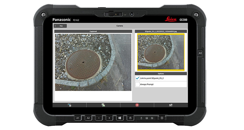
The 2 MP front webcam with microphone and the 8 MP rear camera with autofocus and LED light allow users to capture images during measurements, improving transparency and enabling workers in the field to report exact on-site conditions and progress back to the office. Users can also utlise the camera to read QR codes for quick and easy point
creation from paper plans.
The integrated GPS allows moderate accuracy positioning without the needing to use a SmartAntenna. This is particularly useful when users to locate specific points for
inspection or other positioning tasks that high level of GNSS accuracy is not required.
