
GPS
We supply GPS/GNSS surveying systems that combine state-of-the-art technology with powerful data management capability. Leica Viva GNSS is a complete range of versatile GPS solutions that offers both fully integrated and totally modular systems. To provide ultimate flexibility, the Leica Viva range takes advantage of four major satellite constellations: GPS (American), GLONASS (Russian), Galileo (European) and Compass (Chinese). We offer training and support to fully integrate the correct GNSS solutions for your business at competitive prices.
-

Leica Captivate (5)
-
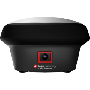
Leica iCON GPS (3)
-
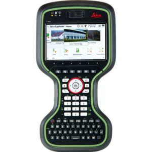
Leica Controllers (6)
-
Leica Zeno (2)
-
Leica Smartnet (1)
-
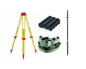
Accessories (22)


Why choose Leica GNSS Solution?
Increase productivity and improve workflows
Leading the way in GNSS innovation, Leica Geosystems developed the world’s first GNSS antenna with an integrated Inertial Measurement Unit (IMU) for true tilt compensation in surveying and staking out. Which increase productivity and streamline workflows, ensuring accurate results and maximizing efficiency on every job site.
Accuracy
The accuracy of measurements depends on multiple factors, with the primary one being the accuracy of the GNSS position. For an RTK solution, the accuracy for models GS18 I, GS18 T and GS16 receiver: typically 8 mm + 1 ppm (single baseline length) horizontally (Hz) and 15 mm + 1 ppm (single baseline length) vertically (V).
One GNSS sensor many applications
Traditional surveys often require both a total station and a GNSS system to measure points inaccessible by GNSS alone. The Leica GS18 I GNSS RTK rover eliminates this need, combining an IMU and camera to measure remote points directly. This versatile solution simplifies equipment deployment and personnel requirements, maximizing efficiency on any surveying project. With the multi-talented Leica GS18 I, one GNSS sensor unlocks countless surveying applications, streamlining workflows and increasing productivity.
How is GPS used in engineering?
From construction and surveying to transportation and environmental monitoring, GPS plays a crucial role in ensuring accuracy, efficiency, and safety.
Surveying and Mapping
Engineers can quickly and accurately map terrain features, infrastructure, and utilities, enabling informed decision-making and minimizing errors.
Construction and Site Management
In construction projects, GPS is utilized for machine control, enabling automated grading and earthmoving operations. It also aids in tracking equipment and personnel, enhancing site logistics and safety.
Environmental Engineering
GPS is employed in environmental engineering for tasks such as monitoring land use changes, tracking wildlife movements, and mapping natural resources.
Training options
At SIS we understand that new technologies create new challenges. With our dedicated training courses, you can easily improve your skills and learn new. For more information contact with our offices in Dublin or Cork. All our courses are customized to your needs.


