
HDS Laser Scanners
Showing all 5 results
At SIS, we offer a comprehensive range of Laser Scanners for High Definition Surveying (HDS), along with the necessary targets and accessories to support every project.
You may also find of interest: Leica BLK Range, Software and Accessories.
-
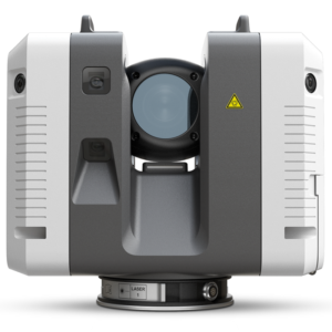
Leica RTC360 3D Laser Scanner
Price on Application -
Leica RTC360 LT 3D Laser Scanner
Price on Application -
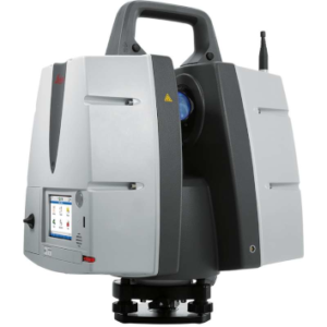
Leica ScanStation P50
Price on Application -
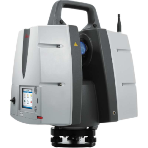
Leica ScanStation P40
Price on Application -
Leica ScanStation P30
Price on Application
3 benefits of using Leica Scanning Solution
Enhanced Efficiency and Productivity
- Rapid data capture: The Leica RTC360 can capture up to 2 million points per second, creating colored 3D point clouds in under two minutes.
- Automated processes: Features like targetless field registration and seamless data transfer from site to office significantly reduce field time and streamline workflows.
- Real-time capabilities: The integration with Cyclone FIELD 360 app allows for real-time scan registration on-site, enabling immediate verification of data quality.
Versatility and Adaptability
- Portable design: The compact and lightweight RTC360 scanner fits into most backpacks, making it ideal for professionals who need to move between multiple sites.
- Wide range of applications: Leica scanning solutions cater to various professionals, including plant designers, archaeologists, CAD professionals, architects, and civil engineers.
- Extreme condition performance: The ScanStation P30 and P40 can operate in harsh environments with temperatures ranging from -20°C to +50°C and conform to IP54 rating for water and dust resistance.
High-Quality Data and Precision
- Low-noise data: The RTC360 provides high-quality, detailed scans with low noise, ensuring excellent precision that can be verified on-site.
- Extended range capabilities: The ScanStation P40 offers superior range, speed, and accuracy, making it suitable for a broad range of applications, including long-range scanning projects.
- Advanced imaging: High Dynamic Range (HDR) imaging system allows for the creation of highly detailed and accurate 3D point clouds, enhancing the overall quality of captured data.
Where can I use laser scanners?
- Architecture and Building Information Modeling (BIM) Creating as-built drawings, capturing 3D data for BIM, documenting historical buildings
- Civil Engineering and Infrastructure Surveying civil infrastructure, capturing 3D geometry of roads and bridges, monitoring structural changes
- Industrial and Plant Design Creating 3D models of facilities, facilitating plant retrofits, assisting in equipment placement
- Archaeology Documenting sites, preserving cultural heritage, assisting in site analysis
- Construction Tracking progress, verifying as-built conditions, quality control and inspection
- Forensics and Crime Scene Investigation Documenting crime scenes, accident reconstruction
- Mining and Quarrying Volumetric calculations, monitoring site changes
- Urban Planning and Development Creating city models, assisting in urban design decisions
- Environmental Monitoring Tracking landscape changes, assessing erosion
- Virtual Reality and Entertainment Creating 3D environments for VR, assisting in film and game production


