
Latest Products
Showing 1–12 of 17 results
At Survey Instrument Services Ireland, we are committed to providing the best survey equipment to help you achieve your goals. Explore our latest products and upgrade your surveying toolkit with state-of-the-art instruments designed for excellence.
-
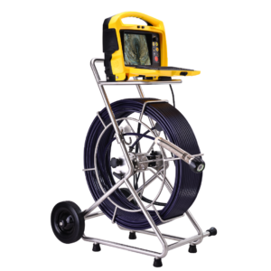
vCam-6 HD Inspection System
Price on Application -
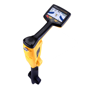
vLoc3-5000 Cable Locator
Price on Application -
VM-510FFL+ Receiver and fault locator
Price on Application -
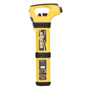
vScan Cable Locator with vScan Transmitter
Price on Application -
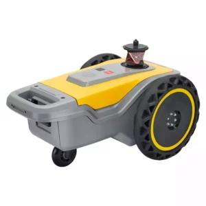
HP SitePrint – Robotic Site Layout Solution
Price on Application -
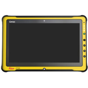
Leica CT1000 LTE Controller
Price on Application -
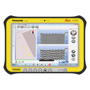
Leica CT2000 Controller
Price on Application -
 Add to Cart This product has multiple variants. The options may be chosen on the product page
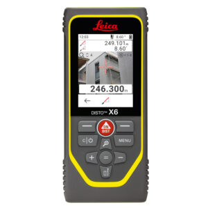
Leica Disto X6 Laser Distance Meter
Price range: €545.00 through €1,275.00 excl VAT (€670.35 incl VAT) -
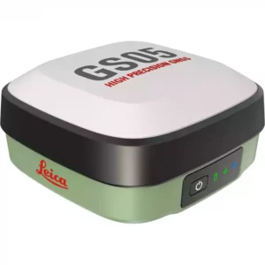
Leica GS05 GNSS RTK Rover
Price on Application -
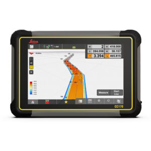
Leica iCON CC170 Controller
Price on Application -
Leica iCON CC200 Controller
Price on Application -
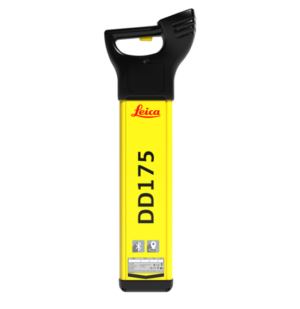
Leica DD175 Cable Locator
€995.00 excl VAT (€1,223.85 incl VAT)
Why Choose Our Latest Survey Equipment?
Our collection features top-of-the-line products designed to enhance accuracy, efficiency, and reliability in every project.
With our extensive range of survey hardware, you’ll find everything you need to ensure unparalleled project success, including robotic layout solutions, Leica detection radar controllers, and more.
Robotic Layout Solutions
Robotic layout solutions revolutionise surveyors’ work by providing automated, precise positioning. These systems are ideal for large-scale construction projects, allowing surveyors to control the equipment remotely and achieve unparalleled accuracy.
- Automated positioning for precise control
- Ideal for large-scale construction projects
- Improves productivity and reduces errors
Leica Detection Radar Controllers
Leica detection and safety radar controllers are essential for identifying underground utilities and ensuring safe excavation. They offer advanced radar technology that allows users to detect and map subsurface objects with high accuracy. Whether conducting a land survey or preparing for construction, Leica detection radar controllers provide the necessary reliability.
- Advanced radar technology for subsurface detection
- Ensures safe excavation
- High accuracy for mapping underground utilities
Leica Disto Laser Distance Metres
Leica Disto laser distance metres are renowned for their precision and ease of use. These devices deliver accurate distance readings in seconds, perfect for various measuring tasks.
Whether you’re measuring distances, areas, or volumes, Leica Disto ensures you get precise results every time. Ideal for both professionals and DIY enthusiasts, these metres are a must-have in any surveying toolkit.
- Delivers accurate distance readings quickly
- Suitable for measuring distances, areas, and volumes
- Ideal for professionals and DIY enthusiasts
Leica Field Controllers
Enhance your surveying projects with our Leica field controllers, which are designed for durability and ease of use in any environment. They offer robust and intuitive interfaces for managing your surveying tasks efficiently.
They also integrate seamlessly with other Leica Geosystems products, providing a comprehensive data collection and analysis solution.
- Robust and intuitive interfaces
- Seamless integration with Leica Geosystems products
- Durable and user-friendly in any environment
Leica Cable Locators
Leica cable locators are essential for detecting and tracing underground cables and utilities. These devices use advanced electromagnetic technology to provide accurate location information, helping to prevent costly damage during excavation—Trust Leica cable locators for precise and reliable utility detection.
- Detects and traces underground cables
- It uses advanced electromagnetic technology
- Prevents costly damage during excavation
Leica Signal Transmitters
Ensure the safety and success of your projects with Leica signal transmitters.
They work in conjunction with cable locators to enhance detection accuracy. By sending a signal through the cables, these transmitters allow surveyors to trace underground utilities more precisely.
- Enhances detection accuracy
- Works with cable locators for precise mapping
- Ensures project safety and success
Leica Imaging Laser Scanners
Leica’s laser survey equipment captures detailed 3D images of the surveyed area, providing comprehensive data for analysis and planning.
These scanners are perfect for complex projects requiring high-resolution imaging and accurate measurements. Enhancing your survey with Leica imaging laser scanners offers unparalleled detail and precision.
- Captures detailed 3D images
- Provides comprehensive data for planning
- High-resolution imaging for complex projects
Leica GPR Survey Equipment
Trust Leica GPR survey equipment for accurate and reliable subsurface data. Designed for deep subsurface exploration, they provide valuable insights into underground structures.
These systems use radar waves to detect and map features below the surface, making them ideal for archaeological surveys, utility detection, and construction planning.
- Detects and maps underground structures
- Ideal for archaeological surveys and utility detection
- Provides reliable subsurface data
Get a Tailored Quote For Any Solution
If you have any inquiries or would like to request a quote, contact us today. Let us help you find the perfect solution for your surveying needs.


