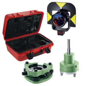
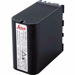
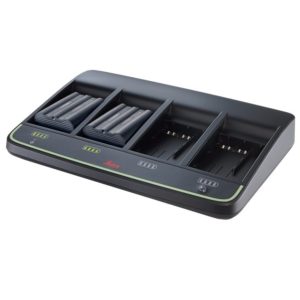
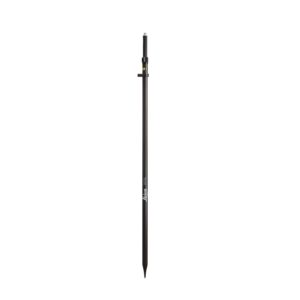
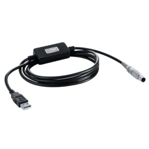
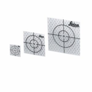
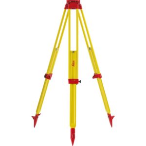
Dublin (01) 456 8650 Cork (021) 423 2957

  • search
  • account
  • 0
    was successfully added to your cart.
Close Search
Survey Instrument ServicesSurvey Instrument Services
search account
0
Menu
  • Products
  • Products
      • GPS
        • Leica Captivate
        • Leica iCON GPS
        • Leica Controllers
        • Leica Zeno
        • Leica Smartnet
        • Accessories
      • Levels
        • Automatic Levels
        • Digital Levels
        • Accessories
      • Laser Levels
        • Construction Lasers
        • Grade Lasers
        • Pipe Lasers
        • Laser Receivers
        • Lino & Dot Lasers
        • Upgradeable Lasers
        • Accessories
      • Detection & SafetyWe have a range of high quality, professional cable and pipe locators which are necessary when doing all types of excavation work. GPS technology provides geographical positioning and data logging records information when in use. Operators can determine the depth of the buried utility, providing an advantage when conducting ground surveys.
        • Software
        • Cable Locators
        • Leica Controllers
        • GPR
        • Accessories
      • ScanningSIS offers the Leica ScanStation portfolio as an integrated part of a complete scanning solution including hardware, software, service, training and support. 3D laser scanner data can be processed in the industry’s leading 3D point cloud software suite, which consists of Leica Cyclone stand-alone software, Leica CloudWorx plug-in tools for CAD systems and the free Leica TruView.
        • Laser Scanners
        • BLK Range
        • Portable
        • Software
        • Accessories
      • Distance MeasuringMeasuring volumes, lengths and distances is extremely simple with the use of a Leica DISTO. At SIS, we supply the full range of Leica Distos available, ensuring you get the right product for your needs, taking advantage of the ultimate in measuring precision.
        • Leica DISTO
        • Road & Rail Wheels
        • Tapes
        • Accessories
      • Total StationsPerfect for all engineering, construction and surveying work. Offering the complete range of Leica Total Stations. The latest distance technology, taking advantage of a suite of on-board programs and many sensor and accuracy options. Our units are perfect for all engineering, construction and surveying projects. We have total stations to suit all levels of project requirements – from manual 2 man units, all the way up to the MS60 MultiStation, the world’s first ‘self-learning’ one-man unit
        • Leica iCON
        • Leica Captivate
        • Leica Flexline
        • Leica Viva
        • Leica Software
        • Leica Controllers
        • Accessories
      • UAV/DronesProfessional commercial UAS / UAV / Drones are today performing missions of surveying, mapping, city-planning, mining, forestry, agriculture, volume calculations, science, wildlife protection and much more.
        • UAV Photogrammetry SoftwarePix4D is a dynamic and rapidly expanding software company with headquarters in Lausanne, Switzerland, and local offices in San Francisco, Shanghai, Berlin, Madrid, Tokyo and Denver. The company develops a line of end-to-end mapping solutions which convert images into georeferenced maps and models. Using advanced algorithms based on computer vision and photogrammetry, Pix4D offers survey-grade accuracy, as well as a unique bundle of desktop and cloud processing.
        • DJI Enterprise
        • Sensors
      • Other
        • USV
        • Mobile MappingThe Leica Pegasus: Two Mobile Mapping Systems uses one or several laser scanners in combination with GNSS receivers, IMU and a DMI. Acquire accurate and precise spatial data with six to eight cameras on any vehicle.
        • Mobile RobotsTinySurveyor is ideal for Height measurement and premarking. The robot is highly precise, effective and reliable.  Easy to operate, digitise the road system, upload coordinates in the specific format that is supported by TinySurveyor (LandXML and CSV) to a USB stick and insert this into the robot.
        • Used Equipment
        • Latest Products
        • Hire Products
  • Industries
    • Building Construction
    • Heavy Construction
    • Surveying
    • Utilities
  • Hire
  • Services
    • Service & Repair
    • Sale Enquiry
    • Technical Support
    • Training Courses
    • Finance Options
  • Blog
  • About Us
  • Contact

Accessories

  • Traverse Kit

    Traverse Kit (3)

  • Batteries

    Batteries (9)

  • Carriers

    Carriers (5)

  • Chargers

    Chargers (5)

  • Detail Poles

    Detail Poles (9)

  • ICON Accessories

    ICON Accessories (9)

  • Prisms

    Prisms (8)

  • Targets

    Targets (3)

  • Tribrachs

    Tribrachs (3)

  • Tripods

    Tripods (9)

50+ Years
Established in 1973

Distributor Partner of
Leica Geosystems

Professional Advice &
Ongoing Support

On-Site
Demonstrations

50+ Years
Established in 1973

Leica Geosystems

Distributor Partner of
Leica Geosystems

Professional Advice &
Ongoing Support

On-Site
Demonstrations

@survey_instrument_services_ltd

Follow Us

The IDS #StreamUP is setting a new benchmark in #G The IDS #StreamUP is setting a new benchmark in #GPR technology—delivering high-density data, lightning-fast acquisition speeds, and seamless mobility for the most demanding environments. 

🔍 Ideal for large-scale infrastructure and urban mapping 
⚙️ Real-time 3D data visualisation with advanced processing tools 
🔋 Modular and lightweight design for all-day field efficiency 
📈 Boost your productivity while minimising time on-site 

Whether you're surveying roadways, airports, or complex utility networks—StreamUP makes deep detection smarter and faster. 

📩 Get in touch to explore demo and hire options available now. 

📞 Dublin: (01) 456 8650 | 📞 Cork: (021) 423 2957 

#SIS #IDSGeoRadar #UtilityMapping #GeospatialInnovation
At #SIS, your equipment is maintained and repaired At #SIS, your equipment is maintained and repaired to the highest standards. With our ISO 9001:2015 certification, we’ve reaffirmed our commitment to quality, consistency, and expert care in every job we do. 

🛠️ Fully certificate service workshop 
👨‍🔧 Manufacturer-trained technicians 
🛠️ Fully certified service workshop 

Whether it's routine maintenance or complex repairs, your instruments are in expert hands. 

📩 Contact our team today to schedule a service or calibration. 

Dublin: (01) 456 8650 | Cork: (021) 423 2957 

#sis #leicageosystems #service #workshop #surveying #constructionireland #civilEng 
#TS16 #DD120 #LeicaICON #icon70 #laserlevel
There’s no such thing as “too early” when it There’s no such thing as “too early” when it comes to precision. 🌅 
Spotted on-site in Cork this morning: the powerful Leica TS16 Total Station, ready to deliver high accuracy from the first light. 

When you hire from #SIS, you're covered any time of day—we deliver reliability, precision, and support from dawn to dusk. 

For hire options contact with our offices: 

📞 Dublin: (01) 456 8650 
📞 Cork: (021) 423 2957 

#TS16 #SurveyingInIreland #TotalStationHire #CorkSitework #LeicaGeosystems
⭐️ What a fantastic night at the Irish Constru ⭐️ What a fantastic night at the Irish Construction Excellence (ICE) Awards Dinner!⭐️

It was an incredible evening spent with industry leaders, friends, and partners who continue to drive excellence across every corner of the sector.
👏Congratulations to all the finalists and huge well done to all winners!

Here’s to another year of raising standards and building a strong future together.
#ICEAwards #sis #LeicaGeosystems #IrishConstruction #SurveyingInnovation

Follow Us

Stay Up To Date

Subscribe to our newsletter and get the latest updates about news and promotions.

  • This field is for validation purposes and should be left unchanged.

Dublin

Unit 6A,
Ballymount Cross Industrial Estate,
Dublin 24,
D24 EC56

(01) 456 8650
Mon – Fri 7:30am – 5:30pm

Cork

Unit 7, Block D,
Euro Innovation Business Park,
Little Island,
Co. Cork,
T45 WP84

(021) 423 2957
Mon – Fri 9am – 5:30pm

info@sisirl.com

Surveying Equipment

  • Total Stations
  • GPS
  • Levels
  • Laser Levels
  • Detection & Safety
  • Distance Measuring
  • Scanning
  • Mobile Mapping
  • UAV/Drones
  • Mobile Robots
  • Used Equipment

Services & Solutions

  • Service & Repair
  • Hire
  • Sale Enquiry
  • Technical Support
  • Training Courses
  • Finance Options
ISO Logo

Useful Links

  • About Us
  • Manuals & Brochures
  • Delivery & Returns
  • Credit Account Application
  • Blog
  • Locations
  • Contact Us
  • My account
  • Terms & Conditions
Weee Ireland Logo
ISO Logo
Weee Ireland Logo

2025 Survey Instrument Services Ltd. Privacy Statement | Terms & Conditions | Delivery & Returns | Website by Effector

This site is protected by reCAPTCHA and the Google Privacy Policy and Terms of Service apply.

Close Menu

Dublin (01) 456 8650 Cork (021) 423 2957

  • Products
  • Products
    • Back
    • GPS
      • Back
      • Leica Captivate
      • Leica iCON GPS
      • Leica Controllers
      • Leica Zeno
      • Leica Smartnet
      • Accessories
    • Levels
      • Back
      • Automatic Levels
      • Digital Levels
      • Accessories
    • Laser Levels
      • Back
      • Construction Lasers
      • Grade Lasers
      • Pipe Lasers
      • Laser Receivers
      • Lino & Dot Lasers
      • Upgradeable Lasers
      • Accessories
    • Detection & SafetyWe have a range of high quality, professional cable and pipe locators which are necessary when doing all types of excavation work. GPS technology provides geographical positioning and data logging records information when in use. Operators can determine the depth of the buried utility, providing an advantage when conducting ground surveys.
      • Back
      • Software
      • Cable Locators
      • Leica Controllers
      • GPR
      • Accessories
    • ScanningSIS offers the Leica ScanStation portfolio as an integrated part of a complete scanning solution including hardware, software, service, training and support. 3D laser scanner data can be processed in the industry’s leading 3D point cloud software suite, which consists of Leica Cyclone stand-alone software, Leica CloudWorx plug-in tools for CAD systems and the free Leica TruView.
      • Back
      • Laser Scanners
      • BLK Range
      • Portable
      • Software
      • Accessories
    • Distance MeasuringMeasuring volumes, lengths and distances is extremely simple with the use of a Leica DISTO. At SIS, we supply the full range of Leica Distos available, ensuring you get the right product for your needs, taking advantage of the ultimate in measuring precision.
      • Back
      • Leica DISTO
      • Road & Rail Wheels
      • Tapes
      • Accessories
    • Total StationsPerfect for all engineering, construction and surveying work. Offering the complete range of Leica Total Stations. The latest distance technology, taking advantage of a suite of on-board programs and many sensor and accuracy options. Our units are perfect for all engineering, construction and surveying projects. We have total stations to suit all levels of project requirements – from manual 2 man units, all the way up to the MS60 MultiStation, the world’s first ‘self-learning’ one-man unit
      • Back
      • Leica iCON
      • Leica Captivate
      • Leica Flexline
      • Leica Viva
      • Leica Software
      • Leica Controllers
      • Accessories
    • UAV/DronesProfessional commercial UAS / UAV / Drones are today performing missions of surveying, mapping, city-planning, mining, forestry, agriculture, volume calculations, science, wildlife protection and much more.
      • Back
      • UAV Photogrammetry SoftwarePix4D is a dynamic and rapidly expanding software company with headquarters in Lausanne, Switzerland, and local offices in San Francisco, Shanghai, Berlin, Madrid, Tokyo and Denver. The company develops a line of end-to-end mapping solutions which convert images into georeferenced maps and models. Using advanced algorithms based on computer vision and photogrammetry, Pix4D offers survey-grade accuracy, as well as a unique bundle of desktop and cloud processing.
      • DJI Enterprise
      • Sensors
    • Other
      • Back
      • USV
      • Mobile MappingThe Leica Pegasus: Two Mobile Mapping Systems uses one or several laser scanners in combination with GNSS receivers, IMU and a DMI. Acquire accurate and precise spatial data with six to eight cameras on any vehicle.
      • Mobile RobotsTinySurveyor is ideal for Height measurement and premarking. The robot is highly precise, effective and reliable.  Easy to operate, digitise the road system, upload coordinates in the specific format that is supported by TinySurveyor (LandXML and CSV) to a USB stick and insert this into the robot.
      • Used Equipment
      • Latest Products
      • Hire Products
  • Industries
    • Back
    • Building Construction
    • Heavy Construction
    • Surveying
    • Utilities
  • Hire
  • Services
    • Back
    • Service & Repair
    • Sale Enquiry
    • Technical Support
    • Training Courses
    • Finance Options
  • Blog
  • About Us
  • Contact

Cookies Information

We use cookies to ensure that we give you the best experience on our website. If you continue to use this site we will assume that you are happy with it.
By clicking “Accept”, you consent to the use of ALL the cookies.

Cookie settingsREJECTACCEPT
Cookies Policy

Cookies Overview

This website uses cookies to improve your experience while you navigate through the website. Out of these cookies, the cookies that are categorized as necessary are stored on your browser as they are essential for the working of basic functionalities of the website. We also use third-party cookies that help us analyze and understand how you use this website. These cookies will be stored in your browser only with your consent. You also have the option to opt-out of these cookies.

But opting out of some of these cookies may have an effect on your browsing experience.
Necessary
Always Enabled
Necessary cookies are absolutely essential for the website to function properly. This category only includes cookies that ensures basic functionalities and security features of the website. These cookies do not store any personal information.
Non Necessary
Any cookies that may not be particularly necessary for the website to function and is used specifically to collect user personal data via analytics, ads, other embedded contents are termed as non-necessary cookies. It is mandatory to procure user consent prior to running these cookies on your website.
Other
No description
Analytics
Analytical cookies are used to understand how visitors interact with the website. These cookies help provide information on metrics the number of visitors, bounce rate, traffic source, etc.
Advertisement
Advertisement cookies are used to provide visitors with relevant ads and marketing campaigns. These cookies track visitors across websites and collect information to provide customized ads.
Performance
Performance cookies are used to understand and analyze the key performance indexes of the website which helps in delivering a better user experience for the visitors.
Save & Accept

Notifications