
Leica Controllers
Showing all 6 results
Enhance your surveying and construction projects with our range of Leica total station controllers, designed for precision, efficiency, and seamless integration with Leica Geosystems’ Total Stations and GNSS receivers.
You may also find an interest: Leica Software, Leica iCON Robotic, Accessories.
-
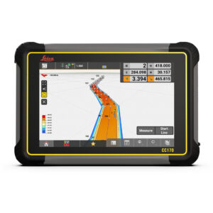
Leica iCON CC170 Controller
Price on Application -
Leica iCON CC180 Controller
Price on Application -
Leica iCON CC200 Controller
Price on Application -
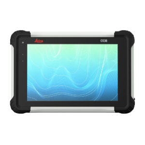
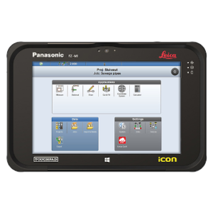
Leica CS30 Tablet
Price on Application -
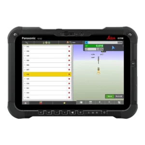
Leica CS20 Controller
Price on Application -
Leica iCON CC70 Controller
Price on Application
What Does a Survey Controller Do?
A survey controller is an essential field controller that integrates with surveying equipment like robotic total stations and GNSS receivers. It:
Measures and Collects Data – Ensures accurate data collection for surveying and construction projects.
Wireless Connectivity – Facilitates real-time data transfer for immediate analysis and decision-making.
Advanced Technology – Supports levelling, 3D modelling, and data management with high accuracy.
Efficient Project Execution – Enables quick commencement and faster completion of surveying tasks with easy-to-use software and advanced features.
Why Choose Leica Total Station Controllers?
Leica Total Station Controllers offer unmatched precision, advanced functionality, and robust performance for surveying and construction applications. These controllers seamlessly integrate with total stations, ensuring efficient data collection and processing.
Advanced Field Software
Leica controllers come equipped with advanced field software, such as Leica iCON and Leica Captivate. This software enhances data collection and processing, ensuring accurate and efficient project management on construction sites and surveying tasks.
Robust and Durable Design
Built to withstand harsh field conditions, Leica controllers like the Leica iCON CCC200 feature rugged designs with high IP ratings, ensuring reliable performance in extreme weather. This durability minimises downtime and ensures consistent operation in demanding environments.
User-Friendly Interface
Controllers like the Leica CS20 field controller offer an intuitive and ergonomic interface, making them easy to use even for those with minimal training. This user-friendly design improves workflow efficiency and reduces the learning curve for new users.
Real-Time Data Transfer
Total station controllers facilitate real-time data transfer between the field and the office, allowing for immediate analysis and decision-making. This capability enhances the efficiency and accuracy of surveying projects, ensuring timely and reliable results.
Integrated GNSS Receivers
Some controllers, like the Leica iCON CC170, are designed with integrated GNSS receivers, providing precise positioning data vital for surveying and construction tasks. This integration ensures high accuracy and reliability in data collection.


