
Leica iCON GPS
Showing all 2 results
From the entry-level iCG30 to the advanced iCG70 T with tilt compensation, our iCON GPS range offers precision and efficiency for every project scale. Experience seamless digital workflows, improved productivity, and unmatched accuracy across various construction applications.
You may also find of interest: Leica Captivate Hire, Leica Controller Hire and Accessories,
-
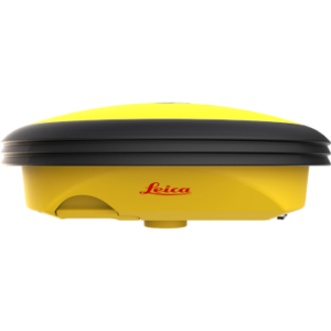
Leica iCON iCG30
Price on Application -
Leica iCON iCG70T
€100/Day , €350/Week
- 1. How to improve site productivity with Leica iCON GPS?
- 2. What are the key differences between iCG30 and iCR70T?
- 3. How does tilt compensation in the iCG70T improve measurements?
1. How to improve site productivity with Leica iCON GPS?
Modernized Measurement Methods
Leica iCON GPS systems replace traditional tapes and strings with digital techniques, significantly accelerating workflow processes.
Precise Stakeout Capabilities
These systems enable quick and accurate stakeout of design elements directly in the field, reducing time and improving precision.
Versatile Applications
From utility construction to landscape gardening and road construction, iCON GPS systems facilitate precise positioning across various project types.
Seamless Software Integration
The integration with iCON field software allows for effortless data collection and transfer between office and field, streamlining project management.
Advanced Features (iCG70 series)
The permanent tilt compensation eliminates the need for pole leveling, saving time and reducing potential errors.
Improved As-Built Documentation
These systems enable faster and more accurate as-built data collection, enhancing project documentation and quality control.
Enhanced Project Timelines
By combining all these features, Leica iCON GPS systems contribute to improved overall project timelines and efficiency in construction projects.
2. What are the key differences between iCG30 and iCR70T?
iCON iCG30:
- Entry-level, economic solution for basic construction measurement tasks
- Ideal for users transitioning from traditional to digital methods
- Suitable for simpler applications like rough stakeouts and basic positioning
iCON iCG70T:
- Advanced GNSS rover with latest technology and IMU
- Features permanent tilt compensation
- Offers higher accuracy and more advanced capabilities
- Suitable for complex construction projects requiring precise measurements
- Integrates with broader iCON ecosystem and Leica ConX cloud platform
3. How does tilt compensation in the iCG70T improve measurements?
Enhanced Flexibility
Measurements can be taken without holding the pole perfectly vertical, increasing adaptability in challenging environments.
Increased Accessibility
Enables data collection in previously hard-to-reach locations, such as building corners or under obstacles.
Improved Productivity
Eliminates the need to level the bubble for each measurement, significantly speeding up the workflow.
Better Quality Control
Tilt values are stored with each measurement, ensuring full traceability and improved data integrity.
Operator Comfort
Reduces physical strain by allowing more ergonomic measurement positions for field personnel.
Higher Accuracy
Minimizes errors associated with manual pole leveling, enhancing overall data precision.
Extended Capabilities
Allows for versatile measurement scenarios, including upside-down measurements when necessary.


