
GPR
Showing all 5 results
You may also find of interest: Cable locators, Controllers & Accessories.
-
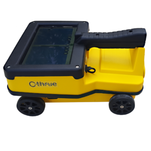
C-Thrue
Price on Application -
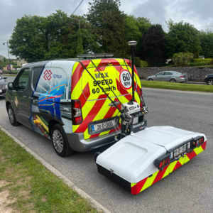
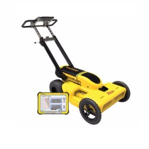
Stream UP
Price on Application -
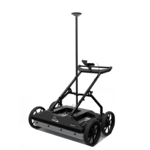
Stream DP
Price on Application -
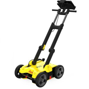
Leica DSX Utility Detection Solution
Price on Application -
Leica DS2000 Utility Detection Radar
Price on Application
- How Accurate is GPR?
- What is a Ground Penetrating Radar (GPR) Used For?
- How much does a GPR cost?
- Advanced Features of our GPR Survey Equipment
How Accurate is GPR?
Our GPR survey equipment provides high-resolution data, capturing detailed images of subsurface structures. This accuracy is vital for utility mapping, geophysical exploration, and concrete scanning. It helps identify underground services and voids accurately, ensuring reliable project outcomes.
The Leica DSX Utility Detection Solution and DS2000 Utility Detection Radar enhance this accuracy with features like real-time data processing and advanced filtering algorithms, which minimise noise and improve signal clarity.
The Stream DP system offers dual-frequency antennas, providing high-resolution data at different depths, making it ideal for detailed subsurface imaging and geophysical surveys.
What is a Ground Penetrating Radar (GPR) Used For?
Our GPR systems suit various applications, including geophysical investigation, utility detection, and subsurface imaging. GPR equipment is also invaluable for geological prospecting and utility mapping, providing flexibility and adaptability for diverse project requirements.
Our comprehensive range of Leica GPR survey equipment offers dual-frequency antennas for detailed subsurface imaging, simplifies detecting and mapping underground utilities with intuitive interfaces, and excels in identifying and mapping underground services in high resolution, making them perfect for urban utility detection and infrastructure maintenance.
How much does a GPR cost?
The cost of Leica’s GPR systems varies considerably, depending on the model and features. For a detailed quote tailored to your specific needs, visit our contact page to contact our sales team for personalised assistance.
Advanced Features of our GPR Survey Equipment
Are you curious about how our Ground-Penetrating Radar (GPR) systems can transform your subsurface imaging projects? From exceptional accuracy to versatile applications, our diverse range of Leica Geosystems GPR technology is designed to meet diverse project needs.
Let’s explore their key features and learn how our systems can enhance your geophysical surveys and utility detection tasks:
Variation Sensitivity
Utilising electromagnetic waves, our GPR systems detect variations in dielectric permittivity and electrical conductivity, ensuring effective identification of subsurface anomalies and geological features. This technology is essential for comprehensive subsurface investigations and accurate data collection.
Efficient Data Processing
With advanced data processing capabilities, our GPR equipment analyses radar signals and travel times, including two-way travel time, to deliver precise subsurface images. This feature enhances the accuracy and reliability of geophysical surveys, making data interpretation more straightforward and efficient.
Unparalleled Durability
Leica GPR systems are built to withstand harsh environments and extreme temperatures, making them reliable for various field conditions. Their robust design minimises equipment downtime and maintenance needs, ensuring consistent performance and enhancing overall project efficiency.
Instant 2D/3D Utility Mapping
Our GPR systems allow for rapidly creating 2D and 3D utility maps on-site. This capability speeds up mapping underground utilities, ensuring efficient and effective project execution.
Real-Time Data Collection
Our GPR systems facilitate real-time data collection and export, allowing for immediate analysis and decision-making on-site. This feature is critical for efficiently managing projects and promptly addressing potential issues.


