
Leica iCON GPS
Showing all 3 results
Streamline operations and maximize productivity with Leica iCON – a powerful integrated system combining advanced hardware like the iCON iCG60 GNSS smart antenna or iCON iCG70T GPS solution integrated with iCON build software. Increase profitability through unmatched efficiency with the tightly integrated, scalable performance of Leica iCON construction solutions.
You may also find of interest: Smartnet, Controllers & Accessories
-
Leica iCON iCG30
Price on Application -
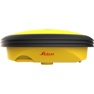
Leica iCON iCG70T
Price on Application -
Leica iCON iCG60
Price on Application
Advanced Surveying Solutions
The Leica iCon GPS series by Leica Geosystems is designed for construction and surveying professionals seeking precision and efficiency. These GPS systems feature advanced GNSS technology, rugged durability, and user-friendly interfaces.
They offer accurate positioning, integrated field software, and reliable performance in challenging environments, enhancing productivity and streamlining tasks on any construction site.
Key Features of the Leica iCon GPS Range
1.Exceptional Accuracy With Advanced GNSS Technology
Leica iCon GPS devices are known for their high-precision measurements, which are essential for detailed surveying and various construction projects, including roadworks, infrastructure development, and high-rise building construction.
They incorporate advanced GNSS technology, combining satellite signals for precise positioning. Integrating inertial measurement units (IMUs) further enhances accuracy, ensuring every measurement is reliable and reducing errors significantly.
2.Rugged Durability
Designed to withstand harsh environments and magnetic interferences, the Leica iCon GPS series is dust-tight, water-resistant, and capable of operating in extreme temperatures.
This robustness ensures consistent performance on challenging construction sites, from hot deserts to freezing arctic conditions, reducing equipment downtime and maintenance needs and enhancing overall project efficiency.
3.User-Friendly Interfaces
Leica iCon GPS devices feature intuitive interfaces and integrated Leica iCon Field software. This combination simplifies task management and data transfer, streamlining system navigation and workflows and reducing learning curves. This user-friendliness ensures increased productivity and efficient operation on-site.
4.Versatility and Adaptability
The Leica iCon GPS series is versatile and suitable for various applications. From large-scale land surveying to precise construction site positioning, features like real-time kinematic (RTK) positioning and compatibility with multiple software solutions ensure adaptability to diverse project requirements, making them ideal for varied tasks.
With our official range of GPS accessories, you can also boost data transfer speeds, safeguard critical project data, and more.
5.Enhanced Productivity
Leica iCon GPS devices are designed to optimise workflow efficiency. They integrate seamlessly with existing systems, reducing manual errors and facilitating faster data processing.
This seamless integration maximises productivity, allowing professionals to complete tasks more accurately and quickly, leading to better project outcomes and efficient resource utilisation.
Need Assistance?
If you encounter any issues, SIS offers tailored technical support services to guide you through any challenges. Our dedicated team is ready to assist, ensuring you can resolve problems quickly and efficiently. For help, contact our expert support team today.


